Page 1 of 1
Highways of Fulor
Posted: 20 Jan 2021, 22:24
by PixelDubs
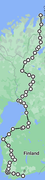
Fulor's Highway 1 is a nice long trip, this road runs for 1043 miles, allow up to 3 weeks to travel the entirety of this road, parts of the road are slow mountain roads or unpaved gravel, mud and dirt.
Map portrayed by Google Maps because why the hell not?
Link to gallery of the road:
https://postimg.cc/gallery/NyHpfsY
Highway Marker Sheild Gallery:
https://postimg.cc/gallery/gz51Qwg
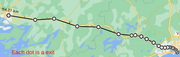
Construction began in 1934, and was completed in
1962, it was also the first motorway in Fulor which runs from Kalipa, the capital all the way to Mocampua.
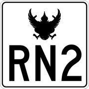
RN2 Is the longest road in Fulor, it acts as a ring road around the entire country, it runs for 1829 miles and takes up to 2 weeks to travel
Marker:
Map:
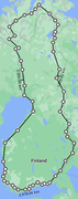
80% of this route is paved, the other 20% is good gravel.
20th Janurary logs
RN1 will be finished by tomorrow at 8PM GMT (now 22nd lol)